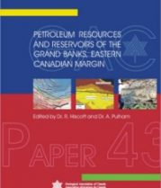
Special Paper 43: Petroleum Resources and Reservoirs of the Grand Banks, Eastern Canadian Margin
09/01/2005Edited by R.N. Hiscott and A.J. Pulham
ISBN: 978-0-919216-82-2
ISSN: 0072-1042
Regular: $78.8
Members: $43.34
$176.00
Members: $96.8
ISBN: 978-0-919216-96-9
ISSN: 0072-1042
This volume provides the earth scientist with many examples of how a Geographic Information System (GIS) in concert with other software (statistical, image analysis) can be useful for addressing various earth science applications that involve spatial analysis of a wide range of geo-science datasets. Examples include mineral resource assessment (mineral potential modelling), analysis and visualization of multi-media geochemical data, geologic mapping, natural hazards assessment and environmental applications.
The volume is not meant to be an instructional textbook on the mechanics of GIS but rather a demonstration of how GIS can be effectively used to address a wide range of applications of interest to the earth scientist. Additionally, the book can serve as a textbook for university and college courses dealing with the application of GIS and spatial modelling.
The book includes a CD-Rom, containing the entire book as a full-colour PDF as well as additional visual information, and is accompanied by a pair of 3-D glasses to better view selected images.
** Also available for digital download by individual chapters at http://www.gac.ca/publications/bookstore.php?category_id=27
Print on Demand – 632 pages, Includes CD-Rom and 3-D glasses (2006)

Regular: $78.8
Members: $43.34

Regular: $111.00
Members: $61.05

Regular: $41.42
Members: $22.78
Cancel